Explore the Trails
Discover the beauty of Sessions Woods with our detailed Trail Map, Bird List and Tree ID Guide.

Our Trails
Our trails are carefully mapped to guide you through the rich biodiversity of Sessions Woods. Each trail offers a unique journey into the heart of nature, from dense woodlands to open meadows. Whether you are an experienced hiker or a casual walker, our maps ensure you have a safe and enriching experience.
We encourage you to use these maps to plan your visit, allowing you to immerse yourself in the natural beauty and educational opportunities offered at Sessions Woods. Remember, as you explore, to respect the environment and stay on marked paths to protect the wildlife and habitats.
Trails
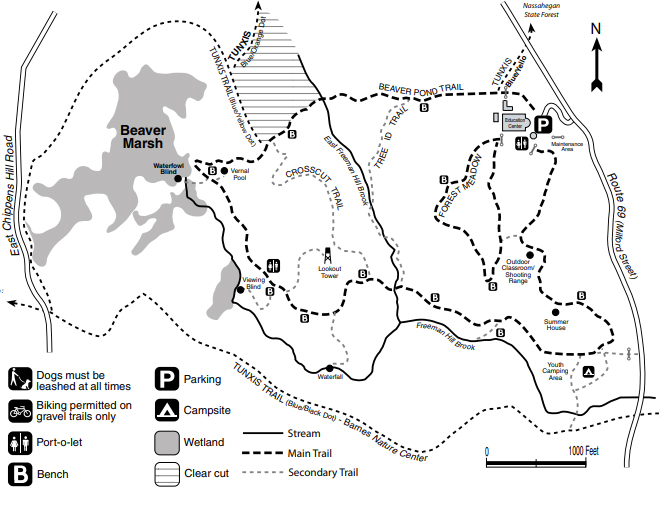
Sessions Woods has four main trails of varying length.
The Beaver Pond Trail is a 2.6-mile gravel trail passing by a 38-acre wetland, an old fire tower and a waterfall.
The Forest Meadow Trail is a gravel 0.6-mile path with demonstration sites showing wildlife management practices for small land tracts.
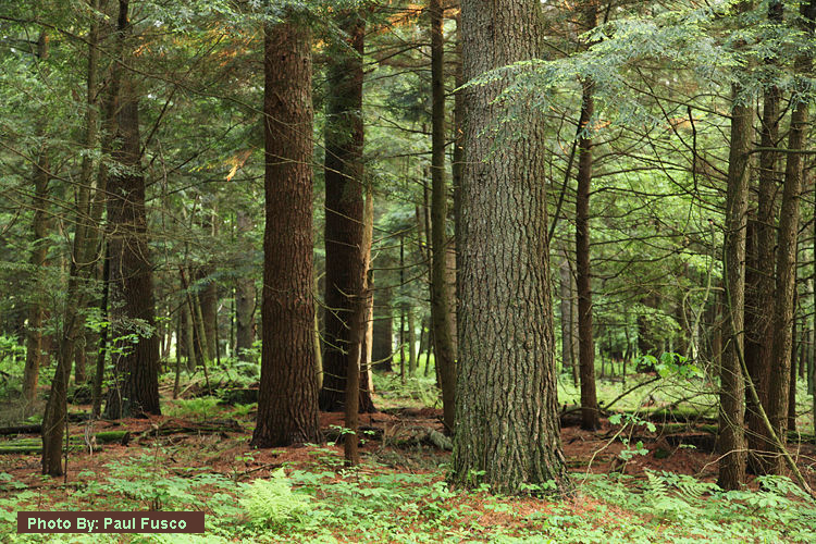
The Tree ID Trail is a 0.4-mile footpath meandering through a variety of habitats from a dry, upland site to a moist brookside.
The Crosscut Trail is a 0.4-mile trail that passes through a 14-acre site cleared in 2001 to improve the health and diversity of the forest, as well as to diversify the wildlife habitat at Sessions Woods. Hike this trail to see how a “new forest” is generated!
Links:
Sessions Woods Brochure & Trail Map
Birds of Sessions Woods
List of birds species and habitats found in Sessions Woods . Check off the birds as you spot them during your walk.
Local Tree Identification Guide
A guide to several species of trees found in Sessions Woods.